The ifp test site Vaihingen/Enz was originally established in summer 1995 for the geometrical performance acceptance test of one of the first operational digital airborne line scanning systems, the Digital Photogrammetry Assembly DPA. Starting from this, the test site was used several times for different kinds of investigations: For the independent in-flight evaluation of new digital airborne sensors as well as for investigations on the potential of direct georeferencing using integrated GPS/inertial systems in combination with standard analogue frame cameras.
The test site itself is located about 20km north-west of Stuttgart/Germany in a hilly area providing several types of vegetation and land use, mostly rural area with smaller forests and villages. It also offers quite steep vineyards and some quarries. The following image shows the river Enz valley east of the small village Rosswag.
The spatial extension of the overall test area is about 7.5 km (east-west) x 4.7 km (north-south). The terrain heights differ between 193m and 356m above mean sea level. The terrain variations are depicted in the following figure (vertical component 2x exaggerated, © Landesvermessungsamt Baden-Württemberg)
The demanding terrain topography can also be seen from the following figures.
Again the vertical component is two times exaggerated. Please click for larger view.
The terrain model available so far is obtained through airborne laser-scanning. Flights were ordered by Landesvermessungsamt Baden-Württemberg. Data acquisition was done in February 2001, using the Optech ALTM 1225 system (flying height 900m, scan frequency 25 Hz, scan angle +/- 25deg, mean point distance on ground approx. 1.5m). The final DTM is available as 1m grid. Vertical accuracy is expected to be better than 0.5m.
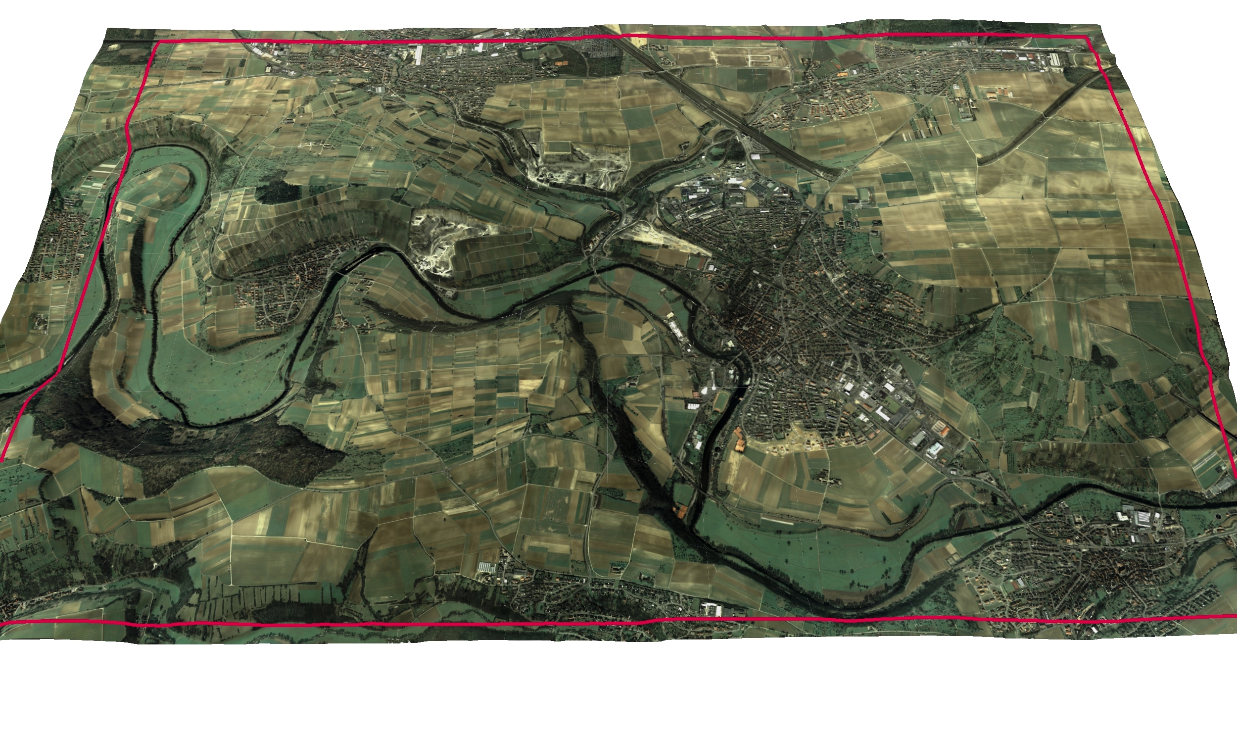
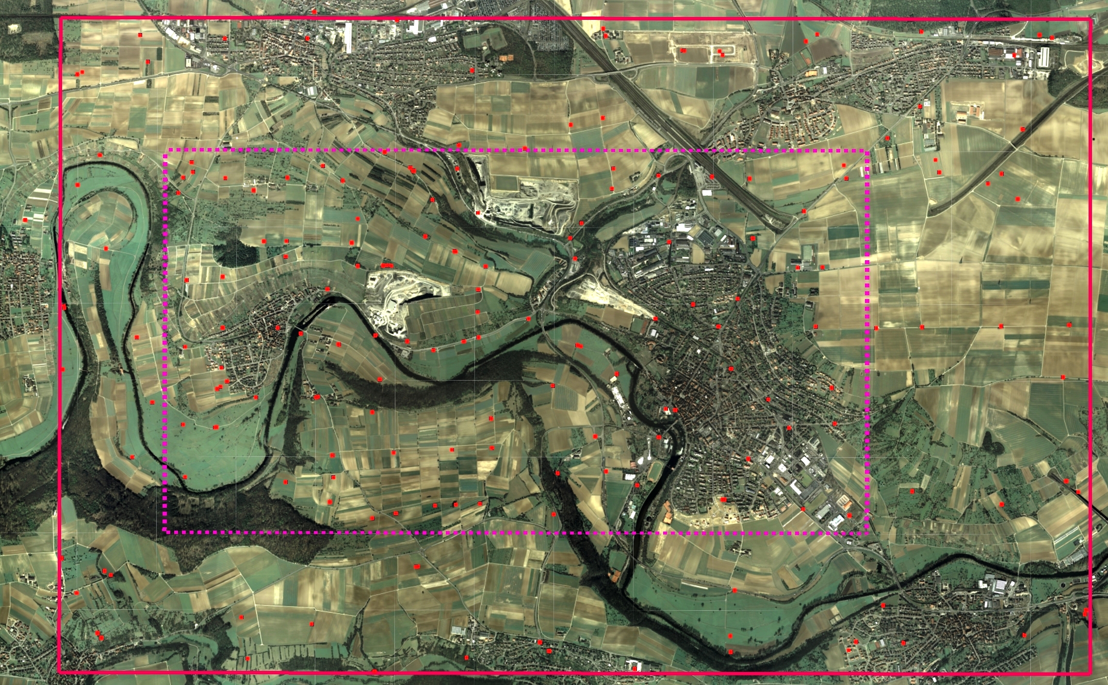
Although the number of ground control points slightly varies throughout the different test flight campaigns their principal locations remain unchanged. The point distribution is densified in the centre part of the area to allow for high resolution and large scale tests. This densified region has an extension of 5.0 km (east-west) x 2.8 km (north-south).
Test site dimensions (in Gauss-Krueger coordinates)
Whole area
| Extensions |
|
Easting [m] |
Northing [m] |
| 7400m (east-west) |
Upper left |
3492450 |
5424350 |
| 4700m (north-south) |
Upper right |
3499850 |
5424350 |
| |
Lower right |
3499850 |
5419650 |
| |
Lower right |
3492450 |
5419650 |
Densified central area
| Extensions |
|
Easting [m] |
Northing [m] |
| 5050m (east-west) |
Upper left |
3493200 |
5423400 |
| 2750m (north-south) |
Upper right |
3498250 |
5423400 |
| |
Lower right |
3498250 |
5420650 |
| |
Lower right |
3493200 |
5420650 |
The object points are painted targets mostly. They are independently coordinated from static GPS surveys, with an estimated accuracy of sigma 2cm for all three coordinate components.
Altogether close to 200 points are available in the test area (flight campaign 2007). In the densified region the smaller 0.3m x 0.3m targets are painted in black in the center of the 0.6m x 0.6m sized white targets.
| # of points |
distribution of points |
| 172 |
whole test site |
Signalized/painted squares 0.3m x 0.3m
| # of points |
distribution of points |
| 103 |
densified region only |
Siemens star
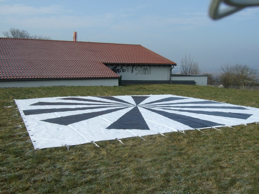
An additional (mobile) resolution target (Siemens star) is prepared for the flights, if the empirically analysis of the geometrical resolution potential of airborne sensors is of interest.
The Siemens star has a diameter of 8m and consists of 12 black/white sections.
The approximate position, where the Siemens star is located (in Gauss-Krueger) during flights is 3497905m (East) and 5422085m (North).
for further information contact
Dr.-Ing. Michael Cramer
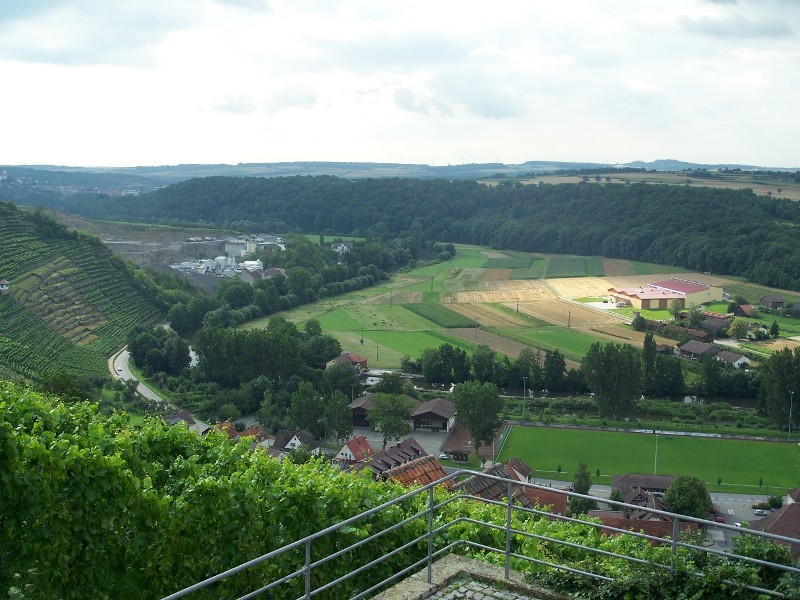
small village Rosswag
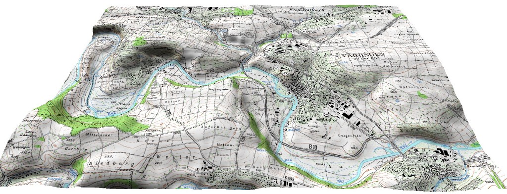
test site terrain
Orthophoto drapped over DTM
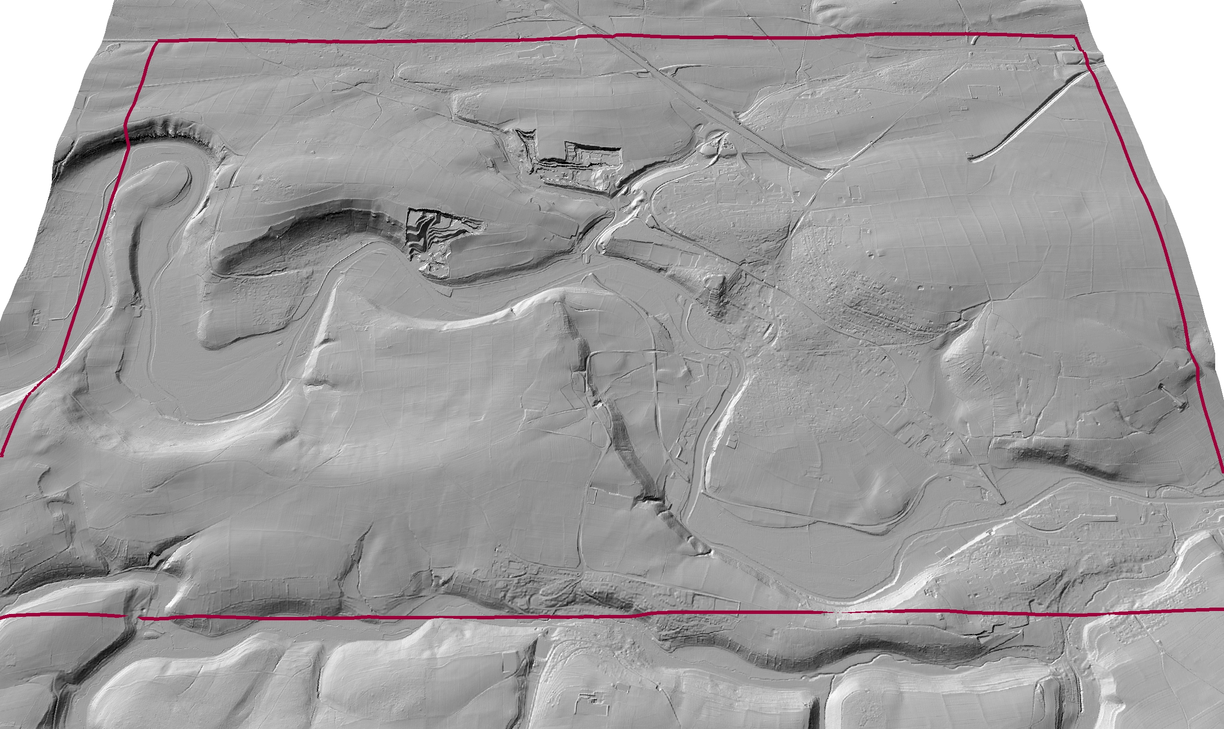
Shaded view of DTM
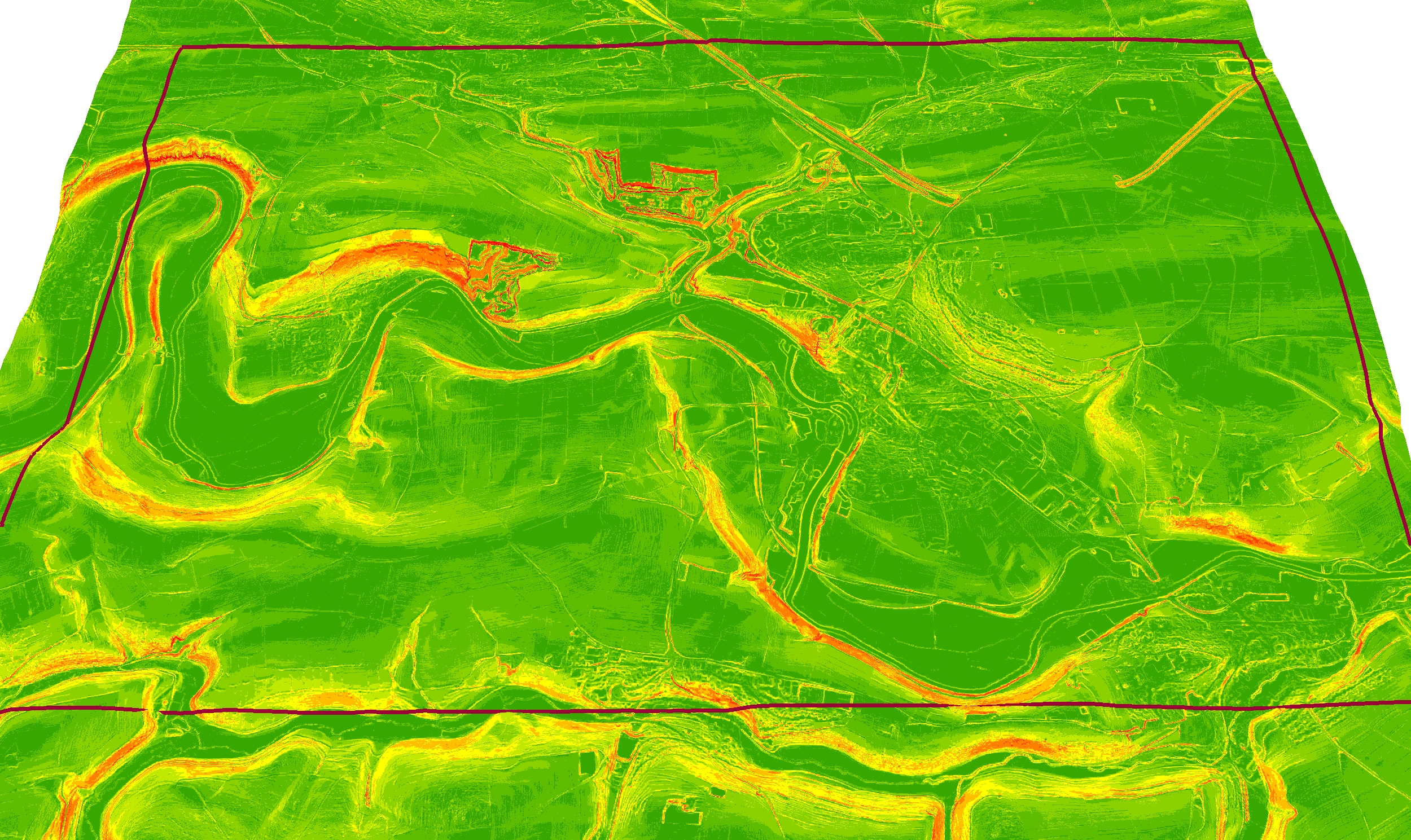
Slope classification from DTM
Test site Vaihingen/Enz