
EuroSDR: ADS40 data set
 |
EuroSDR networkDigital Camera Calibration |
The ADS40 data set
The ADS40 data set was processed by 3 network members only. Typically the different flying heights were considered as separate, in one case the final object coordinates were obtained from sub-sequent mean of results from low and high flying height. Since two of the participants provided several versions, altogether 31 different versions were evaluated.
The absolute accuracy was obtained from check point analysis. The Vaihingen/Enz test site provides more than 200 signalized or natural points roughly, but not all of them visible in all flights and flying heights. 12 points were distributed as control points. Thus, close to 200 points were available for check point analysis. In case the differences at some individual check point were significantly larger than the remaining ones, the pilot centre eliminated those point(s) from further analysis. This was done to minimize the influence of obvious errors in image measurements on the system accuracy analysis.
The (anonymized) results from the ADS40 participants are given
below. Please note, ADS low flying height corresponds to 1500m above
ground (GSD 0.18m, non-staggered), ADS high corresponds to 2500m
above ground (GSD 0.26m, non-staggered). Besides, the two blocks are
of different structure and overlap conditions. Details on the data
itself were already given in
EuroSDR-Phase2-Data-ADSDisc.pdf
(![]() )
)
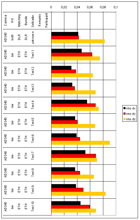 |
| Figure 1: Both and low flying height |
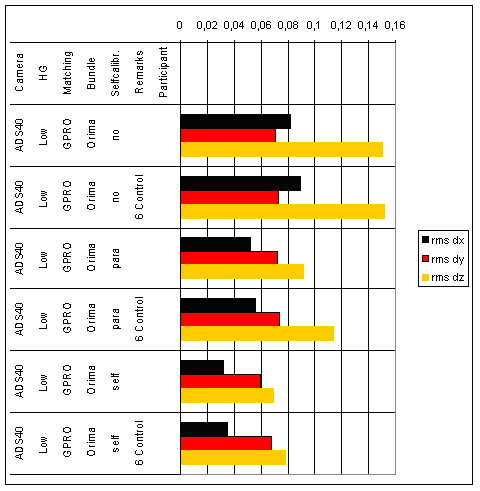 |
| Figure 2: Low flying height |
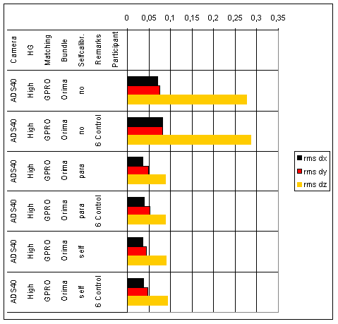 |
| Figure 3: High flying height |